
The weather we rely on for agriculture is only going to get worse
Written by Nick Breeze
Published: 02 December 2017
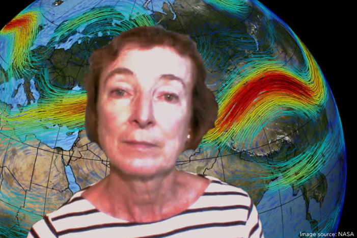
The jet stream is responsible for what kind of weather we experience and it’s behaviour is changing. Dr Jennifer Francis, a research professor at Rutgers University's Institute of Marine and Coastal Sciences, explains how a combination of factors are going to drastically impact agricultural systems in Europe and Eurasia.
It is easy to look at the fires in southern Europe and think that “global warming” is a regional problem often on someone else doorstep. This misconception could not be further from the truth because the “global” bit refers only to global mean temperature. As scientists start to look at what is happening around the world, it becomes very clear that the interconnected global system is changing for all.
Nick Breeze: How would you describe the role of the jet stream in our weather system?
Jennifer Francis: The jet stream is what controls all of our weather. Whether it is cold, warm, wet, dry, the recent research is starting to explain in more detail how climate change in general is influencing the jet stream in the neighbourhood of Europe.
There are a lot of pieces to this puzzle and they differ whether we are talking about winter or summer. We are learning that the effects of climate change on the jet stream in the neighbourhood of Europe and Eurasia in general really depends on other we are talking about winter or summer and different areas but the overriding connection is that we expect to see weather patterns become more persistent.
So whether you are in a rainy pattern or a dry pattern, a cold pattern or a hot pattern, we expect those kinds of conditions to last longer. So for example, this past summer much of Europe north of the mediterranean, including Spain and Italy, experienced a very hot dry summer and a lot of it was record breaking. It produced a lot of fires and it was really tough for a lot of places.
Whereas the UK and Scandinavia had just the opposite. They were cold and raining and that went on for most of the summer.
So it really depends on how these north south undulations of the jet stream happen to set-up in any particular year but the basic idea is that what ever you have got is going to stick around longer.
Overall we expect to see southern Europe get drier over time but there will be years that are not fitting that pattern precisely. This year did seem to be consistent with the overall tendency for southern Europe that we expect to see happen more often in the future; more heatwaves, more dry conditions that last a long time which become droughts which then fuel fires, unfortunately.
We expect to see that happen more often.
Nick Breeze: What are the major influences on the jet stream?
Jennifer Francis: That’s also becoming more clear with recent research. We know that there are many factors involved, some of them are naturally occurring fluctuations in temperatures of the north Atlantic ocean. Where these temperatures are situated when there is a colder than normal water verses a warmer than normal water that effects these waves in the jet stream set-up.
But also there seems to be a very definite effect from the fact that we are losing the spring snow cover much faster, especially over northern Eurasia and Northern Siberia. What happens with that is that when you lose that snow, earlier in the spring, when the sun is very strong, you expose the soil underneath it much earlier, which allows it to dry to sooner, and then once it is dry it can heat up very fast.
So this all year drying and warming of the northern latitude land areas is having an impact on the jet stream that is, just as I was describing earlier, causing the waves in the jet stream to become stuck in place.
We have seen this happen quite often in the last few years, the heatwave in Europe of 2010, the Russian heatwave, the heatwave in Europe in 2003, the Pakistan floods; these are all heatwaves that occurred because the waves of the jet stream were trapped, they were stuck in place.
We expect to see that kind of pattern happening more often as we go into the future and lose even more snow earlier in the spring season.
Nick Breeze: So you are saying we are going to have more sticking patterns which will in turn lead to more negative impacts on agriculture?
Jennifer Francis: Unfortunately I am afraid that is the case. But, as we were just saying there will be some years that will be much wetter than normal. It really depends on how these waves in the jet stream end up getting situated in any given year.
This again goes back to things like whether the anomalies or unusual temperature patterns in the Atlantic, that can have an influence on where these waves tend to get set-up.
But then as we look towards this warming Arctic and the loss of snow cover in the spring, that influence tends to make these waves be more persistent. So it is kind of a combination of what the natural world is experiencing in terms of its fluctuations and then how it interacts with this rapid warming and snow loss, in terms of the summer, that we are seeing happening most years over northern Eurasia.
Nick Breeze: That loss of snow cover over northern Eurasia and the loss of snow ice in the Arctic are direct results of global warming. Have you come across any countervailing forces that could reverse these trends?
Jennifer Francis: There is some recent work that makes all this more complicated and that is the fact that we are seeing a lot more freshwater emerging off the ice cap of Greenland and also coming out from the Arctic ocean and it is tending to cause a cooler than normal ocean temperature area south of Iceland and between Iceland and Greenland and that area.
It has been called the cool blob. Having this extra fresh water sitting on the surface of the ocean in that particular location is important because that is one of the areas of the global ocean where the cooling processes during the winter time actually create the large-scale ocean currents that circulate the globe.
By having that extra water there it is making it harder for the atmosphere to have an impact in the formations of the deep part of the ocean.
So this then ties back to the gulf stream because the warm part comes up the East part of north America and then it comes across to northern Europe and it keeps Europe much warmer than it would be otherwise for its latitude.
So anything that effects that position of the gulf stream, the strength of the gulf stream, the temperature of the gulf stream, is going to have a direct impact on weather, especially in the UK and western France and that area.
This is throwing a big wrench into understanding what is going on. It is still a very new topic in terms of research but there are observations as well as modelling studies that suggest that this is probably something that is real and is connected to global warming and climate change because that water that I was just describing is due to the melting of the Greenland ice cap and also the melting of sea ice in the Arctic and the extra inputs from the rivers that run into the Arctic.
Nick Breeze: Does the freshwater run off not simply mix in with the saltwater?
Jennifer Francis: Well it does to some extent but because fresh water is lighter than salt water it tends to float on top. By having that layer sat on top it actually prevents cold from being transferred down into the deeper layers. It is disrupting the normal amounts of heat and dynamics and motion that are being transferred to the deeper layers of the ocean.
Nick Breeze: Are we closer to the beginning of the jet stream variation or are we closer to the end? There is a lot of feeling that we are going to reach a plateau around 2?C and we’ll just adapt to that. Is there anything you have seen that indicates that we are going to stop there, before then or after then?
Jennifer Francis: Sadly no. We are continuing to warm rapidly. The Arctic this past year set all time records for the amount of warming that happened up there. It was for the whole winter for 2015-16 almost 5?C warmer than usual. That is a ridiculously warm Arctic that we saw.
And that was combined with global record temperatures as well, pushing that 1.5?C threshold that the Paris Accord has set as the ideal place to stop. The globe as a whole is already bumping up against that.
We will lose more sea ice, especially in the summer time. We will get sea ice forming in the winter for a long time to come because it is still dark for 6 months of the year up there in the winter, that is not changing. It is really the summertime sea ice that we are seeing decrease more than other seasons.
At some point in the next 30 or 40 years we are going to have a summer with no sea ice at all, or very close to it. At that point there maybe a levelling off of the effect that the Arctic has on the jet stream, but in the summer, the jet stream is going to continue to expand into the spring and into the fall because we are changing those transition sequences even more as we lose the sea ice earlier and it takes longer for it to freeze.
Nick Breeze: When you say that at the point when we lose the summer sea ice we will see a levelling off of the impact on the jet stream, that’s a pretty bad place to be anyway, isn’t it, at the point where it is levelling off?
Jennifer Francis: Right, it is not levelling off at a good place. But even if in the summer, we lose all the sea ice, we are still going to have the Arctic ocean warming more because by losing all that ice, we will have a lot more of the suns energy being absorbed by the ocean. So, even if we lose all the ice, we’ll still be warming more. It is not going to level off flat but maybe in the summer it is just going to be more slowly.
Nick Breeze: When the ocean heats in the Arctic, is that what then prevents the reforming of ice the following winter and drives the trend of less ice the next year?
Jennifer Francis: Right, if you dump a load of extra heat into the Arctic ocean, you are going to delay the freezing and if you do that you are shortening the time period when you can make ice during the winter. You end up with a thinner ice cover overall and we are definitely seeing that happening. It much clearer in the observations that the ice cover is much thinner now that it was only thirty years ago.
Credit : https://envisionation.co.uk/index.php/nick-breeze/210-weather-agriculture-jennifer-francis